The Transcaucasian Trail: Paving a Way Through Nature's Wonders and Mysteries
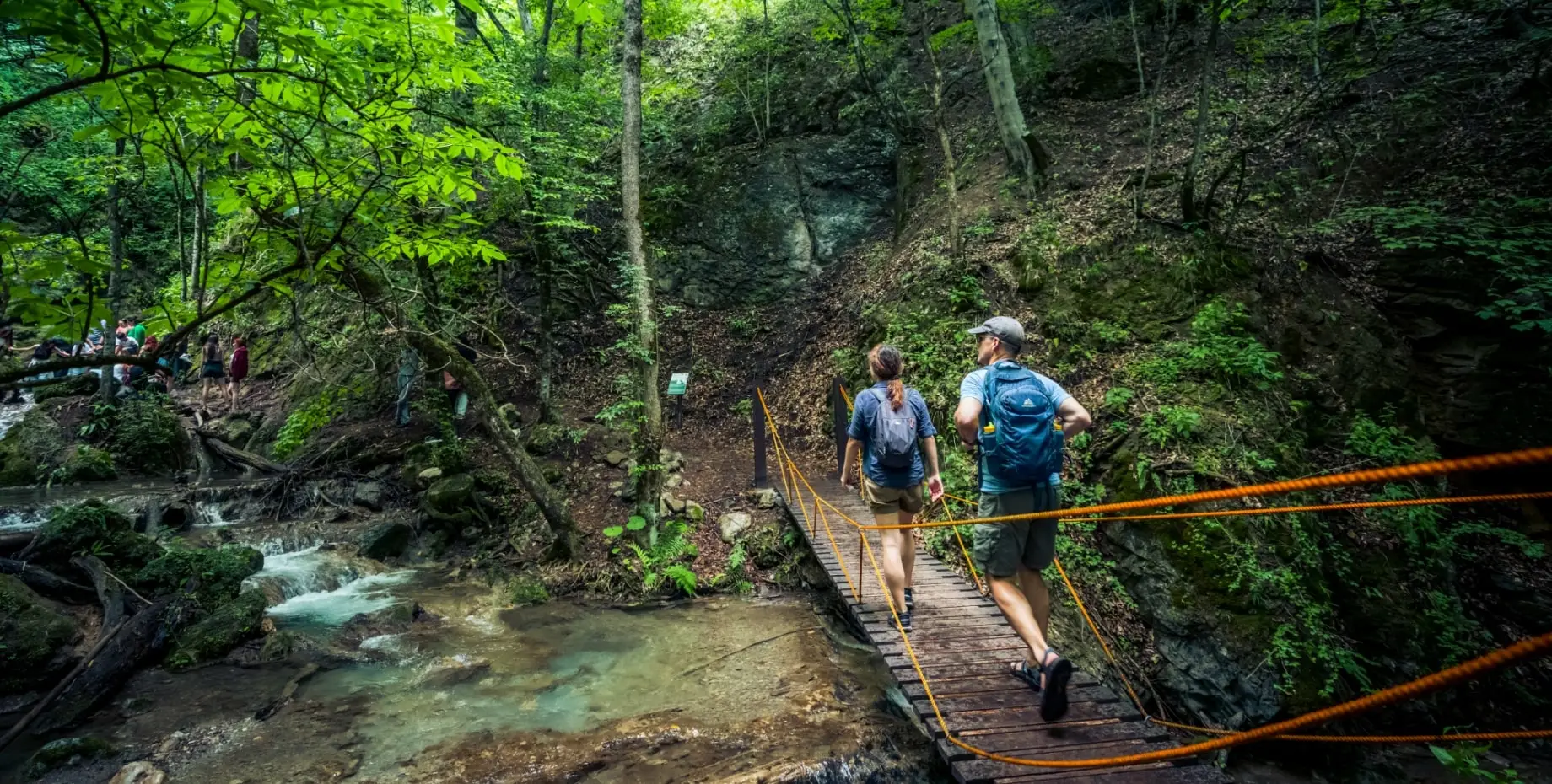
Imagine this: A 3,000 km long, world class hiking trail, making its way through the magnificent wilderness. A web of routes interconnecting dozens of national parks and protected areas going through Armenia and Georgia, a seemingly never-ending route to conquer. Now this is hiking aficionado’s dream, no?
It only gets better. In fact, this trail is located in a region that is rarely visited even though it’s filled to the brim with Historical heritage. A mysterious patch on the world map that is a cultural and historical melting pot. To keep it short, this region is a sequence of cultural gems and biologically diverse ecosystems waiting to be explored.
To add the cherry on top, this won’t be just an out of this world adventure into some of this world’s best kept secrets, the journey will also be enriching on a human and social level. In fact, these regions are famous for the hospitality of their locals. After all, Armenians are well known to love guests, so don’t be startled or skeptical if you’re passing by a village and an Armenian family invites you for a mouthwatering feast to get your energy levels up before you continue your way.
Who, What, and When
The Transcaucasian Trail was born in 2015 when Tom Allen, an explorer who was eager to discover the fascinating Nature in the South Caucasus (or Transcaucasia) region which borders Europe, Asia and the Middle East, realized that there was a lack of paths and connected routes. He decided to make one, and when he discovered a similar project had been started in Georgia, the two teams decided to work together.
Soon after, a big number of hiking enthusiasts from Armenia, Georgia and all over the world as well as cartographers, explorers and nature lovers joined forces to make this mission a reality.
From early on, the idea of this project was so promising and groundbreaking that it was the recipient of the Royal Geographical Society’s Land Rover Bursary, a grant to support funding the exploration and mapping of the route. The English car manufacturing giant didn’t stop there and has also given the team access to a specially-modified 4x4 which Allen considers as a ‘’mobile base camp’’ that has enormously facilitated and supported their trail development journey.
Up to this date, thanks to the effort of more than 50 volunteers from 11 countries, there are already several sections on this long-distance route that are ready to be explored.
So, Where to Start...
Dilijan National Park
In Armenia, the trail in Dilijan National Park is a great option to start. With a distance just short of 80 Km, the journey lasts about 4 to 5 days and it’s definitely an exciting one! Other than the density of its forests and landscapes, ad its scenic lakes such as the Gosh or Parz, this area is also dense from a cultural point of view, with many centuries’ old edifices such as the Haghartsin and Goshavank monasteries (10th century) as well as some lesser known but equally fascinating landmarks which we leave the pleasure of discovery to you.
Dilijan is a popular destination not far from the capital Yerevan, and several hiking trails pass through Dilijan National Park, making this a prime destination for a long or short hike. You can download the TCT interactive map here.
The Geghama Mountain Trail
With its 114 Km length in an isolated area passing by some volcanic domes, you won’t be only starting your hike on a quiet note, but this 5-to-7-day journey may also be the trigger of a spiritual journey for you. And trust us, the views here are breathtaking! For centuries, this path has been taken by nomads, tribes and communities such as the caravanserai from the early 14th century on. There is a sense of mystery and unity with nature that is quite unique to this place.
You can find the TCT interactive map for the Geghama mountains here.
The Vayots Dzor Province
This is a 125 km journey in the Southern region of Armenia, that holds on its path a series of gems waiting for your visit. Anything from a selection of the richest and most diverse fauna and flora, to the Silk Road caravanserais, to some UNESCO listed monasteries, and even the world’s oldest known winery… The list is long!
This section of the Hike will take 6 to 7 days to be completed and every single step and moment is worth your while.
You can find the TCT interactive map for the Vayots Dzor trail here.
The longest section of the trail at the moment is in Svaneti,Georgia the northwestern part of the country, an equally picturesque region.
Downloadable guides to make things easy
You can easily explore the Transcaucasian Trail without any guides, all that you need can be found in the TCT written guides, interactive maps, and GPS data which you can download. All is very well thought out and organized in order to provide the perfect and smoothest hiking experience.
The Transcaucasian Trail is a wonderful idea that is coming to life bit by bit, a little more each year. Just like a puzzle whose pieces are gathering together, getting us more and more excited as we get closer to the finish line. In fact, this trail is so great, that none other than Time magazine has included it in its annual World’s 100 Greatest Places list in 2019. Yes, you’ve heard it right, a trail making it to the list of ‘’greatest places’’ … that’s indeed a first!
Forbes has described the Transcaucasian Trail as ‘’this is a beautiful way to immerse yourself in the Armenian culture’’... and we couldn’t agree more!
The Transcaucasian Trail Official Website, Facebook Page, Instagram
Author: Grace Jerejian
Image Credits: The Transcaucasian Trail
The Transcaucasian Trail ... paving a way through nature's wonders and mysteries
Published on September 11, 2025